1477 AD
Greece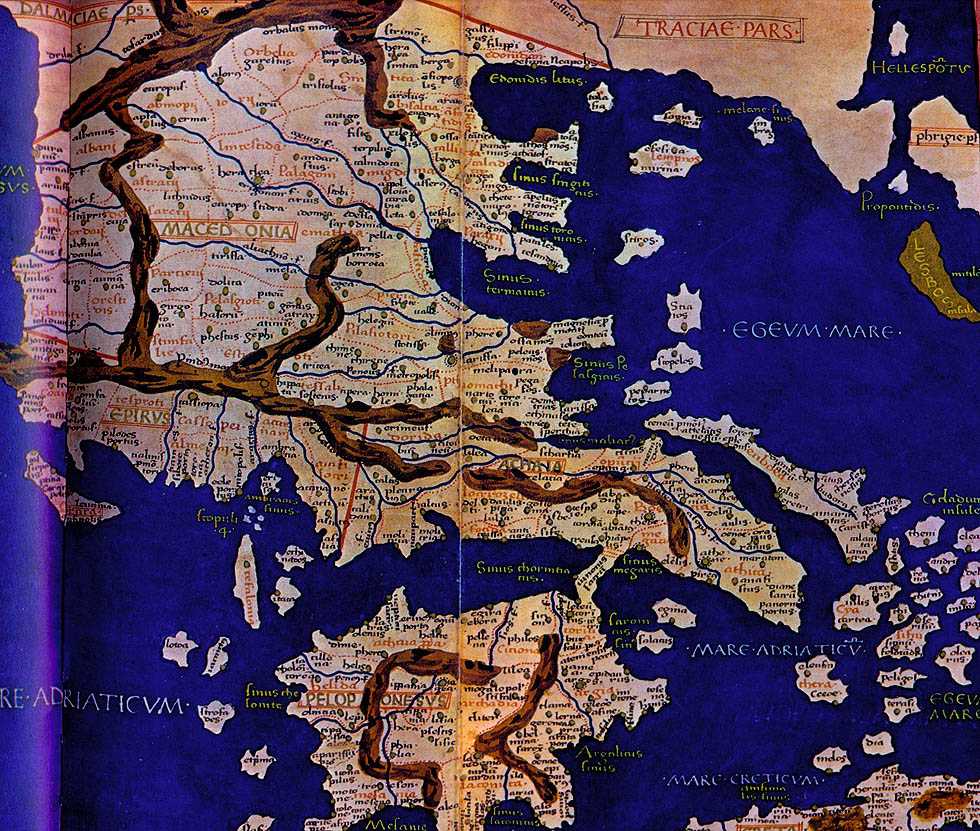
Tabula decima et Ultima Europae(Alexandria)
S.Ptolomaios
Bologna, 1477
The Yale Map Collection
This map shows ancient Macedonia, divided into named regions and showing the mountains, rivers and towns. It was taken as the foundation for great number of maps, especially historical ones. It was printed in Bologna in 1477. This is the first map ever printed and the science of cartography takes 1477 as the year marking the beginning of map printing.